

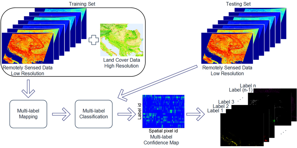
Multi-label Land Cover Classification |
|
Obtaining an up-to-date high resolution description of land cover is a challenging task due to the high cost and labor intensive process of human annotation through field-studies. We introduce a radically novel approach for achieving this goal by exploiting the proliferation of remote sensing satellite imagery, allowing for the up-to-date generation of global-scale land cover maps. We consider the application of multi-label classification, a powerful framework in machine learning, for inferring the complex relationships between acquired satellite images and the spectral profiles of different types of surface materials. |
|
 |
|
|
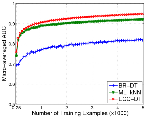
We introduce a drastically different approach compared to unsupervised spectral unmixing, where we employ contemporary ground-collected data from the European Environment Agency to generate the label set, and multispectral images from the MODIS sensor to generate the spectral features, under a supervised classification framework. To validate the merits of our approach, we investigated several state-of-the-art multi-label learning classifiers and evaluate their predictive performance with respect to the number of annotated training examples, as well as their capability to exploit examples from neighboring regions or different time instances. We also demonstrate the application of our method on hyperspectral data from the Hyperion sensor for the urban land cover estimation of New York city. Experimental results suggest that the proposed framework can achieve excellent prediction accuracy, even from a limited number of diverse training examples, surpassing state-of-the-art spectral unmixing methods. |
|
 |
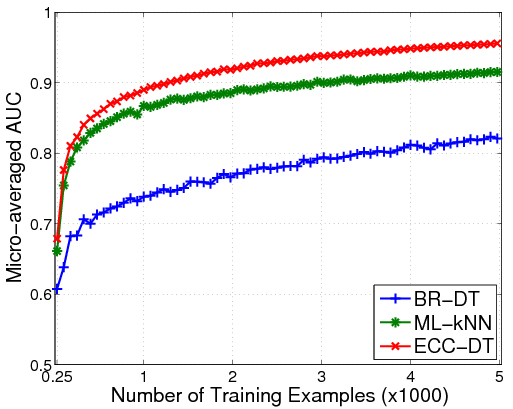 |
Classification performance w.r.t. the number of training examples for two different tiles. |
|
 |
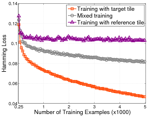 |
Classification performance with respect to the amount of training data for a tile originating from a different spatial location (left) or a different time instance (right) using ECC-DT.
|
|
Publications:
|
|
Achievements